Import AccuMap Data into Petra using a well list


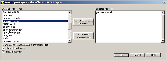
Export data from AccuMap into Petra using an automated process that prompts you for AccuMap export details, launches Petra, and then prompts you for Petra import details. The spatial extents of the data are defined by the bounding wells in the list. Data includes well, production, grid, culture, Open Layers, and shapefile data in NAD83 or NAD27 format.

Export functionality is available in AccuMap using either the Detail Map menu, or Well List Manager.

Petra creates new projects by default in the directory specified in the registry. To specify a different location, add the following to the Petra.ini file found in the Petra installation location (either on the server for a network setup, or on the local machine for a standalone setup):

[ACCUMAP]
PRIVATE_PATH=c:\Geoplus1\Projects
PUBLIC_PATH=c:\Geoplus1\Projects

To import AccuMap data into Petra using a well list

  1. With the Petra application closed, using AccuMap and depending on whether you want to use the Detail Map menu or Well List Manager, do one of the following:
  • Detail Map menu: Select Detail Map > Well Lists > Launch Petra, and using the Launch Petra with Well Lists dialog box that appears, select the desired well list, and then click OK.
  • Well List Manager: Select Tools > Well List Manager.
    The Well List Manager dialog box appears and the main menu bar options change to reflect Well List Manager options.
    Select Well List Manager > Well List > Open, and select the desired well list. Data is exported using the datum option defined in the Datum Settings pane of the AccuMap Defaults dialog box (Edit > Defaults menu). To select different options, from the Well List Manager menu, select Export > Coordinate Info.
    Select Well List Manager > Export > Launch Petra.
  1. Using the Petra Launch Options dialog box, select import options.
  2. Select the types of data to include.
  • If you select Additional User Tops, in the left window, select a users database of tops and click Add.
  • If you select Open Layers / Shapefiles, click Select Files to display the Select Open Layers / Shapefiles for Petra Export.
    select_open_layers_shapefiles_for_petra_export
    Select whether to display Open Layers and Shapefiles below the Available Files pane, select the desired files, and then click Add (or simply click Add ALL to copy all files displayed in the Available Files pane), and then click OK.
  1. Using the Petra Launch Options dialog box, click OK.
Petra automatically launches and begins importing AccuMap data. Petra displays import statistics and then prompts you to load the AccuMap data.
  1. Select Yes.
The Import Petra AccuMap File dialog box appears.
Generally the default options are appropriate; however, click below for a description of the various options on each tab:
  1. Click OK to dismiss the Import Petra AccuMap File dialog box and load the well data.
The AccuMap Petra Production Import dialog box appears.
  1. Select the desired production data to import, and ensure Convert Canadian UWIs from "Display" to "Raw" Form is selected on the File tab.
    Load all of the available production streams and cumulative production values in the Production and Injection tabs. Click below for a description of the various options on each tab:
    AccuMap Petra Production Import: File
    AccuMap Petra Production Import: Production
    AccuMap Petra Production Import: Injection
    AccuMap Petra Production Import: Gas Analysis
    AccuMap Petra Production Import: Gas Composition
    AccuMap Petra Production Import: AOF
  2. Click OK to dismiss the AccuMap Petra Production Import dialog box, and then click OK to dismiss the confirmation message and finish loading the well data.
The Petra Main Module appears when the data finishes loading.
  1. Using the Main Module, click the Mapping button (Mapping_button), and click Yes when prompted to load AccuMap grid and culture files.
The Import Cartographic Data dialog box appears.
  1. Select the manner in which to process imported cartographic data, and then click Import. Click below for a description of the various options on each tab:
    Import Cartographic Data: File
    Import Cartographic Data: Limits
    Import Cartographic Data: Layers
    Import Cartographic Data: MISC
    Import Cartographic Data: T-R-S
    Import Cartographic Data: Translate
If culture was included in the original AccuMap export, the Import Cartographic Data dialog box appears a second time with AccuMap Culture File (CDF) displayed in the File Type drop-down list on the File tab and additional tabs to review.
  1. Select Replace Current Layer Data with the Imported Data in the Layer Update Mode pane and select an unassigned layer (Layer #X, where X is a sequential number), and then click Import.